 English
 Español
 Português


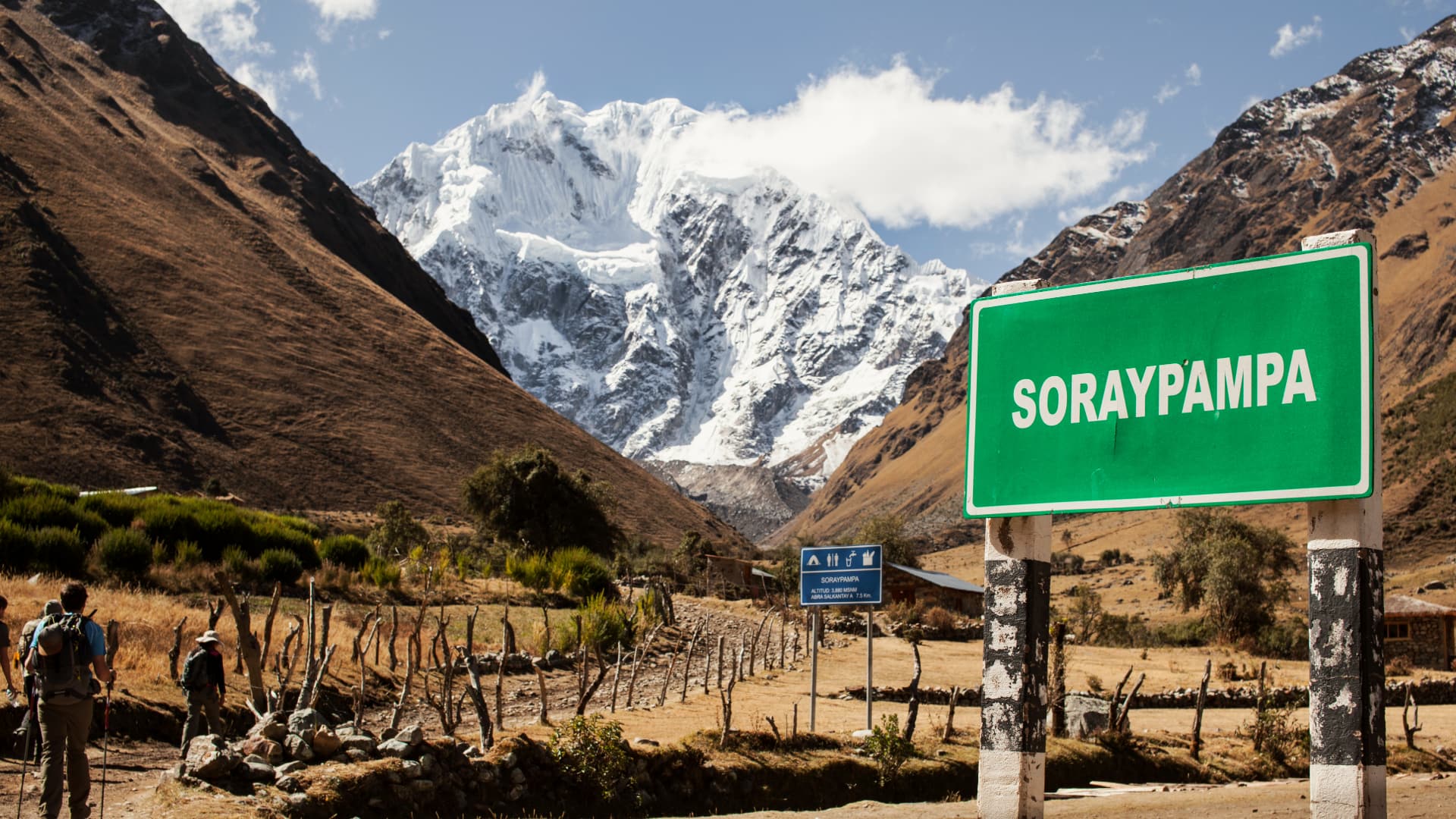
Salkantay is a snow-capped peak in Cusco, Peru, about 6,270 m (20,570 ft) high, the tallest in the Vilcabamba range. It also names the multi-day route that crosses its pass, at about 4,600 m (15,100 ft), to reach Machu Picchu. It is the best alternative to the Inca Trail: no limited permit, and it goes from snow to jungle.
We are local guides based in Cusco, and we take travelers along this route every season. In this guide we cover the route day by day, the altitudes, how to prepare, how it compares with the Inca Trail and Lares, the best time to go and what to pack.
What Is Salkantay in Peru?
Mount Salkantay rises to about 6,270 m (20,570 ft) — figures vary slightly depending on the source — and is the highest mountain of the Vilcabamba range, in the Cusco region. Its name is usually translated as “wild mountain”. For Andean communities it is an apu, a sacred mountain, which is why people on the route speak of it with respect.
When travelers talk about Salkantay, they almost always mean the trekking route that passes at the foot of the mountain and ends at Machu Picchu. In just a few days you change worlds: from high grasslands, lakes and glaciers down to the cloud forest (ceja de selva), with rivers, tropical vegetation and coffee farms. That variety of climates and landscapes is what makes it so special.
Salkantay Peru Route Day by Day: Mollepata to Machu Picchu
This is the classic route, just as we walk it on our 5-day, 4-night Salkantay Trek to Machu Picchu. Altitudes are approximate.
| Day | Route | Overnight |
|---|---|---|
| 1 | Pickup in Cusco around 4:30 a.m., drive to Mollepata and hike to Soraypampa (about 3,900 m / 12,800 ft). Climb to Humantay Lake (about 4,200 m / 13,800 ft). | Camp in Soraypampa |
| 2 | Climb to the Salkantay Pass (about 4,600 m / 15,100 ft), the highest point of the route, then a long descent to Chaullay (about 2,900 m / 9,500 ft). | Camp in Chaullay |
| 3 | Descent through the Santa Teresa valley, now in the cloud forest, to Lucmabamba, a coffee-growing area. | Camp, usually in Lucmabamba |
| 4 | Climb to Llactapata, an Inca viewpoint with a distant view of Machu Picchu. Descent to Hidroeléctrica and a walk along the railway to Aguas Calientes. | Hotel in Aguas Calientes |
| 5 | Bus up to Machu Picchu, visit to the citadel, bus down and return train. | — |
Day 2 is the toughest, because of the climb to the pass and the long descent that follows. On day 3 you are already hiking in heat and humidity, among rivers and lush vegetation. Day 4 brings the reward: from Llactapata you see Machu Picchu in the distance, across the valley, before heading down to Hidroeléctrica.
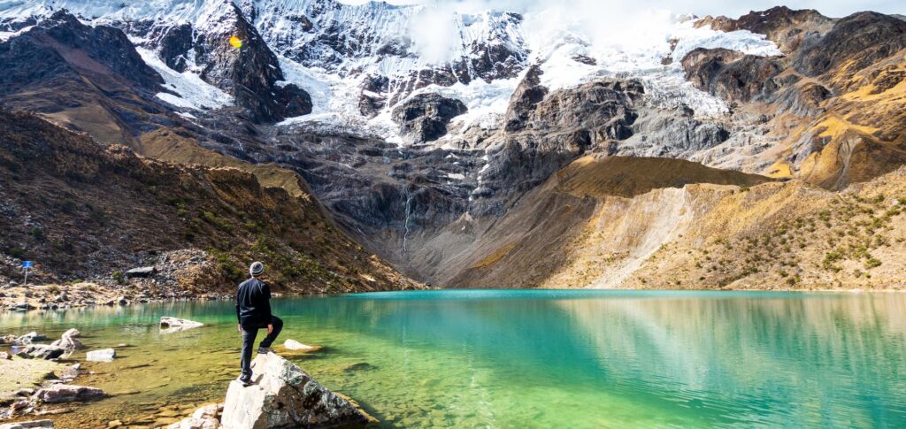
Humantay Lake, with its turquoise water at the foot of the glacier, is one of the highlights of the first day. If you only want to see the lake, you can also visit it in one day on our Humantay Lake tour. We tell you everything about it in our Humantay Lake guide.

Altitude and Acclimatization: Elevations Along the Route
The route climbs and drops a lot. In the first two days you go from about 3,900 m (12,800 ft) to about 4,600 m (15,100 ft), and then descend almost 1,700 m (5,600 ft) in a single day. These are the approximate altitudes of the main points:
| Place | Approximate altitude | What it means |
|---|---|---|
| Cusco | About 3,400 m (11,150 ft) | Where you acclimatize before setting off. |
| Soraypampa | About 3,900 m (12,800 ft) | First night: it gets very cold after sunset. |
| Humantay Lake | About 4,200 m (13,800 ft) | A steep climb and a good test of your acclimatization. |
| Salkantay Pass | About 4,600 m (15,100 ft) | The highest point. Walk slowly and breathe calmly. |
| Chaullay | About 2,900 m (9,500 ft) | Milder: you will notice the change in climate. |
| Machu Picchu | About 2,430 m (7,970 ft) | A comfortable altitude after the mountains. |
The most important thing is to arrive acclimatized. We recommend spending at least two or three days in Cusco or the Sacred Valley before you start, with light activities. On the trail, drink water, eat light meals, climb at your own pace and tell your guide if you have a strong headache, nausea or dizziness. We explain the symptoms and how to prevent them in our guide to altitude sickness in Peru.
How Hard Is It? Difficulty and Preparation
This is a challenging route, harder than the Classic Inca Trail, for two reasons: the altitude of the pass, at about 4,600 m (15,100 ft), and the longer total distance. It is not technical and you don’t need high-mountain experience, but you do need good fitness and the will to hike several hours a day for several days in a row.
Here is how to prepare:
- Train on climbs: in the weeks before, hike hills or take the stairs, ideally with a light backpack.
- Acclimatize first: spend two or three days in Cusco before day 1.
- Use trekking poles: they help a lot on the long descents of days 2 and 3. If you don’t have any, you can rent them in Cusco.
- Wear broken-in boots: never use brand-new footwear on a multi-day hike.
On our Salkantay Trek you are not on your own: muleteers and their horses carry the kitchen equipment and tents (you carry your own personal belongings, so pack light), a cook prepares the meals and your guide sets a pace that suits the group. You can focus on walking and enjoying the scenery.
Salkantay vs. Inca Trail vs. Lares: Which Peru Route to Choose?
These are three multi-day routes to Machu Picchu from Cusco, and each one has its own character. Here is how our tours compare:
| Salkantay | Classic Inca Trail | Lares | |
|---|---|---|---|
| Duration | 5 days / 4 nights | 4 days / 3 nights | 4 days / 3 nights |
| Highest point | About 4,600 m / 15,100 ft (Salkantay Pass) | About 4,200 m / 13,800 ft (Dead Woman’s Pass) | About 4,400 m / 14,400 ft |
| Limited permit | No | Yes, and spaces sell out | No |
| Scenery | Snow peaks, lakes and cloud forest | Inca sites along the way | Andean valleys and farming communities |
| Arrival at Machu Picchu | From Aguas Calientes, by bus or on foot | On foot, through the Sun Gate | From Aguas Calientes |
| Price | US$550 | US$650 | US$450 |
| Best for | Those who want mountains and varied scenery | Those who want to walk an original Inca path | Those who prefer a quieter route |
If your dream is to enter Machu Picchu on foot along an Inca path, choose the 4-day Classic Inca Trail and book it early; we explain permits in our Inca Trail guide. If permits are gone or you want more mountain scenery, Salkantay is the best alternative. And if you are looking for something less demanding, take a look at our Lares Trek to Machu Picchu.
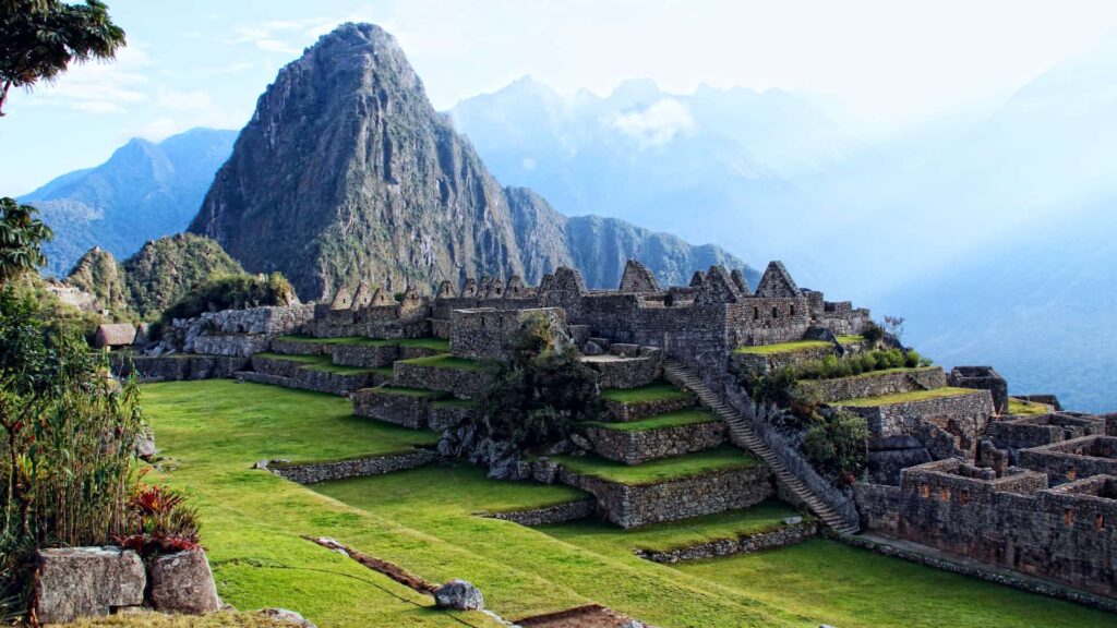
Keep in mind that the Salkantay route does not reach the Sun Gate on foot: the hike ends in Aguas Calientes, and from there you go up to the citadel by bus (included in our tour) or on foot. To compare every option, read our guide on how to get to Machu Picchu.
Book with 40%: our 5-day, 4-night Salkantay route can be booked by paying just 40% online. The balance is paid when you arrive in Peru.
When Is the Best Time to Go?
The best time is the dry season, from April to October, with more clear days and better views of the mountain. It is also the busiest season, so it is worth booking ahead. November to March is the rainy season: the landscape is greener, but trails can be muddy and clouds often hide the peaks.
In any month, be ready for two very different climates: very cold nights in Soraypampa and at the pass, and humid heat in the cloud forest, between Chaullay and Aguas Calientes. You’ll find month-by-month details in our guide to the best time to visit Cusco.
What to Pack: Gear List
- Sleeping bag for intense cold: not included in the tour; you can rent one in Cusco.
- Trekking poles: also not included, and also available to rent in Cusco.
- Layered clothing: a thermal base layer, a fleece and a warm jacket for the heights, plus light clothes for the jungle.
- Rain jacket or poncho: mountain weather changes quickly.
- Broken-in hiking boots and comfortable sandals for camp.
- Beanie, gloves, sunscreen, sunglasses and a sun hat: the sun at altitude is strong even when it’s cold.
- Insect repellent: there are mosquitoes in the cloud forest.
- Reusable bottle and energy snacks for the climbs.
- Physical passport: you need it to enter Machu Picchu.
Frequently Asked Questions
How difficult is Salkantay?
It is challenging. The highest point, the Salkantay Pass, is at about 4,600 m (15,100 ft), and the total distance is longer than the Inca Trail. It is not technical, but you need good fitness and should arrive well acclimatized.
Do I need a special permit?
You don’t need the limited Inca Trail permit. You do need the Machu Picchu entrance ticket and the Humantay Lake entrance; on our tour, both are included.
Can you see Machu Picchu during the hike?
Yes, from a distance. On day 4, from the Inca viewpoint of Llactapata, you can see Machu Picchu across the valley. On day 5 you visit the citadel.
Is it very cold at camp?
Yes, especially on the first night in Soraypampa, at about 3,900 m (12,800 ft). Bring a good sleeping bag and warm clothes. From day 3 onward, in the cloud forest, nights are milder.
What does your tour include and how much does it cost?
Our 5-day, 4-night tour costs US$550. It includes entrance to Machu Picchu and Humantay, the return train, the bus up and down, muleteers, horses, a cook, camping and one hotel night in Aguas Calientes. It does not include a sleeping bag or trekking poles.
How do I book?
You pay 40% online to confirm your spot and the balance when you arrive in Peru. Since the dry season is the most popular, we recommend booking in advance.
Plan Your Mountain Journey to Machu Picchu
This route combines a sacred snow peak, a turquoise lake, the passage from snow to jungle and the arrival at Machu Picchu. Arrive acclimatized, train on climbs, pack for both cold and heat, and choose the dry season if you want the best views.
If you are planning your whole trip, our Peru itinerary helps you fit in acclimatization days in Cusco. When you are ready, book our Salkantay Trek to Machu Picchu by paying just 40% online and the rest when you arrive in Peru.


