English
 Español
 Português


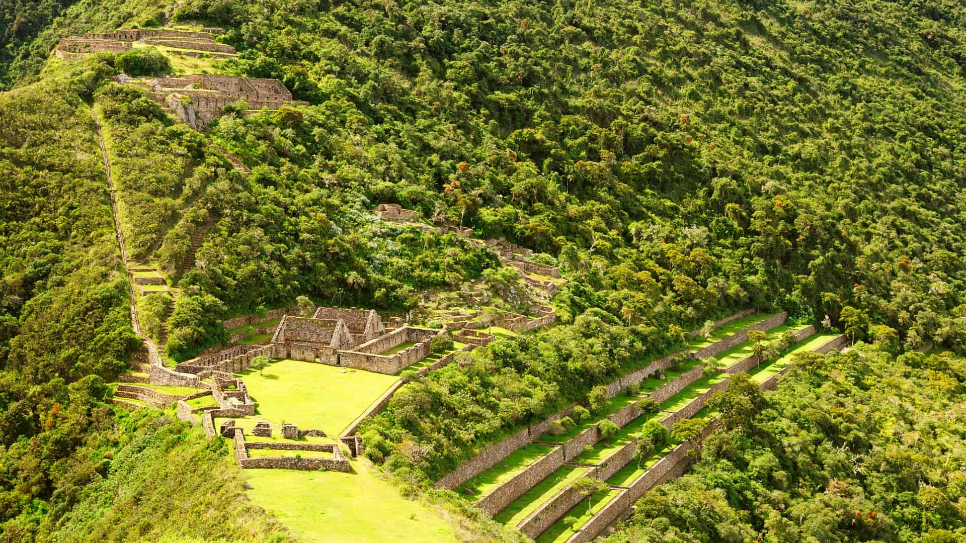
How hard is the Choquequirao trek? Hard: we rate it as difficult. The challenge is not the altitude but the Apurímac Canyon. You drop to the river at about 1,500 m (4,920 ft) and climb back up to the citadel at about 3,050 m (10,010 ft), both ways, with heat below and cold above.
We are a local operator in Cusco and run our own departures to Choquequirao. Here we explain where the effort comes from, how to prepare and whether it is right for you. Access from Cusco is covered in our guide on how to get to Choquequirao, and the history of the site in our guide to the Choquequirao ruins.
How hard is the Choquequirao trek? Why it is so tough
It is roughly 62 km (about 38.5 miles) round trip on the same trail. The path is not technical, but it demands good fitness for four days in a row. What wears you out is the combination of four things:
- The elevation change: from the river to the citadel you climb roughly 1,500 m (4,920 ft), and you repeat the descent and the climb on the way back.
- The long descents: going down into the canyon is harder on the knees than the climbs.
- The heat below: at the bottom of the canyon the sun is strong and the days are hot. The Andean air is dry, so it is easy to get dehydrated.
- The cold above: nights at the higher campsites are cold and the weather changes quickly.
Altitude, on the other hand, matters less than on other routes: the citadel sits at about 3,050 m (10,010 ft), a little lower than the city of Cusco, at about 3,400 m (11,150 ft). Even so, we recommend spending at least 1 day in Cusco before you start so you arrive acclimatized.
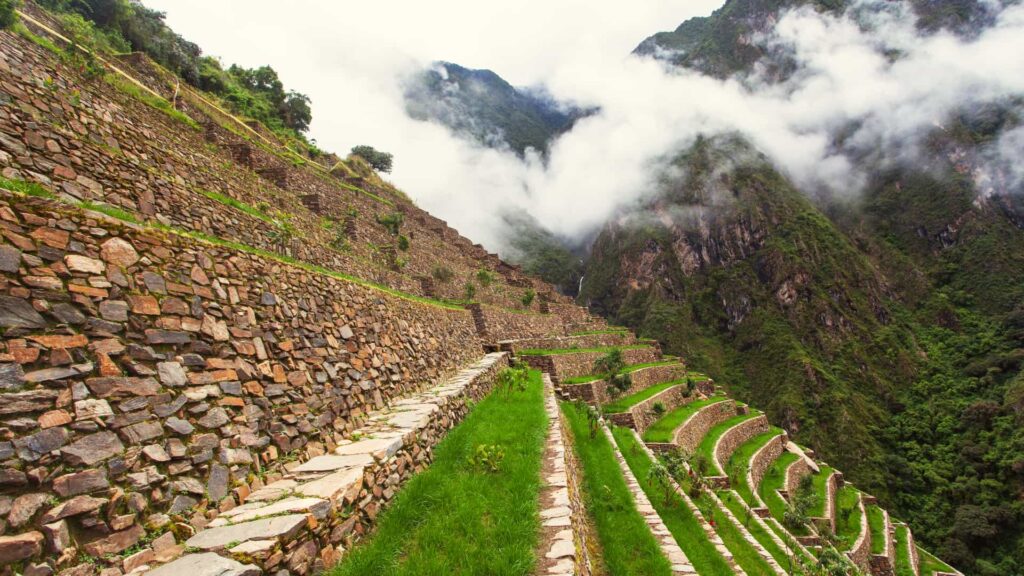
Choquequirao altitude and elevation gain: the Apurímac Canyon
The profile shows the main points of the route and their approximate altitude. More than the highest point, look at how many times you go down to the river and back up.
Approximate elevations. The highest point is marked in red. See the tour from US$450
| Point | Approximate altitude | What it means for your legs |
|---|---|---|
| Capuliyoc | About 2,900 m (9,510 ft) | Start and finish: you begin by going down and end by going up. |
| Playa Rosalina | About 1,500 m (4,920 ft) | The lowest point, beside the Apurímac River. This is where it gets hottest. |
| Marampata | About 2,850 m (9,350 ft) | The end of the hardest climb on the route. |
| Choquequirao | About 3,050 m (10,010 ft) | The highest point, still below Cusco. |
To compare Choquequirao with other destinations, see our Cusco elevation chart.
Choquequirao difficulty vs the Inca Trail, Salkantay and Lares
Difficulty and maximum altitude as listed on each tour page. Choquequirao has the lowest maximum altitude of the four and, even so, it is among the hardest.
| Trek | Difficulty | Maximum altitude | The hardest part | Tour | From |
|---|---|---|---|---|---|
| Choquequirao, 4 days | Difficult | About 3,050 m (10,010 ft) | The canyon’s elevation change, on the way in and out, and the heat by the river | Choquequirao Trek | US$450 |
| Classic Inca Trail, 4 days | Difficult | About 4,215 m (13,830 ft), Dead Woman’s Pass | The stone steps and the second day | Classic Inca Trail | US$650 |
| Salkantay, 5 days | Moderate to difficult | About 4,600 m (15,090 ft), Salkantay Pass | The altitude of the pass and the total distance | Salkantay Trek | US$550 |
| Lares, 4 days | Moderate | About 4,450 m (14,600 ft), Ipsay Pass | The Ipsay Pass, on the second day | Lares Trek | US$450 |
On the Inca Trail, Salkantay and Lares, the big challenge is crossing a pass above 4,000 m (13,120 ft). On Choquequirao it is going down into the canyon and back out. Choquequirao also does not end at Machu Picchu and does not need a permit booked months in advance. Compare the three Machu Picchu routes in Inca Trail vs Salkantay vs Lares.
Book with 40%: you pay only 40% online and the balance when you arrive in Peru. Since Choquequirao has no permit quota, you can book up to 2 days before departure. From May to September, the high season, spots fill up sooner, so it is best to book 1 or 2 months ahead.
What is the effort like, day by day?
This is a summary of the effort on our 4-day, 3-night itinerary. The full detail of each day is on the page of our Choquequirao trek.
- Day 1, the descent: about 4 hours by road from Cusco to Capuliyoc (2,900 m / 9,510 ft) and a long descent toward Chiquisca, where we camp. Your knees work from the very first day.
- Day 2, the hardest: early in the morning you go down to Playa Rosalina (1,500 m / 4,920 ft), cross the Apurímac River and start the demanding climb to Marampata (2,850 m / 9,350 ft). After a rest you continue to Choquequirao (3,050 m / 10,010 ft) and camp near the citadel.
- Day 3, the citadel: this is not a rest day. The sectors are spread over steep slopes, and the terraces with the stone llamas lie below the main sector, with a descent and a climb back. You sleep in Marampata.
- Day 4, out of the canyon: you go down to Playa Rosalina again and climb to Capuliyoc, where the transport is waiting. It is a long day: you get back to Cusco between 6:00 and 7:00 p.m.
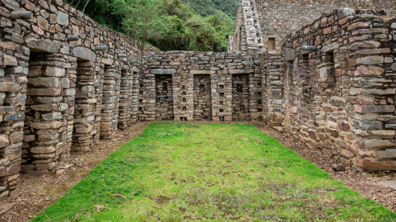
Guide’s tip: exploring the main sector, the usnu and the llama terraces at a relaxed pace takes several hours. Save some energy for that day.
How to prepare for Choquequirao
No high-mountain experience is needed, but you must arrive in good shape:
- Train on hills: in the weeks before, go on long hikes with climbs and descents, with a light backpack if you can. If you live somewhere flat, nearby hills or stairs will do.
- Build experience: ideally, do a multi-day hike beforehand, so you know how your body handles several long days in a row.
- Look after your knees: use trekking poles, especially on the long descents; they also help on the climbs. If you do not have any, we can rent them to you.
- Wear broken-in boots: waterproof, with good grip and ankle support. Never break in new footwear on a multi-day trek.
- Walk at your own pace: a slow, steady pace that lets you hold a conversation. The guide adjusts the breaks to the group; rest whenever you need to, especially on the climbs to Marampata and Choquequirao.
- Drink water: at least 2 to 3 liters a day, because the air is dry and the canyon is hot.
- Arrive acclimatized: spend at least 1 day in Cusco or at a similar altitude. Symptoms and how to prevent them are in our guide to altitude sickness in Peru.
If you have knee problems or any health condition, talk to your doctor before your trip.
What do you carry, and what should you bring?
On our tour you do not carry the camp: porters and muleteers carry the tents, the kitchen and the food, and you only carry your daypack. A cook prepares every meal on the trek, and the group travels with a first-aid kit and emergency oxygen.
| Item | On the tour | On your own |
|---|---|---|
| Tents, sleeping mats and kitchen | Included; carried by porters and muleteers | — |
| Meals | Breakfast, lunch and dinner during the trek | Extra snacks and drinks |
| Sleeping bag | Not included | Bring your own or rent one from us |
| Trekking poles | Not included | Optional; we can rent them to you |
| Entrance to Choquequirao | Included | — |
| Travel insurance | Not included | You arrange it |
Your 20 to 30 liter daypack holds water, snacks, your camera and an extra layer. Add layered clothing (light for the canyon heat and warm for the night), a hat and gloves, sunscreen, sunglasses, a wide-brimmed hat, a rain jacket, a headlamp, insect repellent and cash in soles, because there are no ATMs on the route. For the rest of your gear, use our list of what to pack for a multi-day trek.
Who is Choquequirao for, and who is it not for?
It is for you if… you are in good physical shape, enjoy long hiking days and want an Inca citadel with very few people around. Even better if you have already done a multi-day hike.
It is not for you if… you want a gentle first trek (Lares, rated moderate, can be your first multi-day hike), your priority is Machu Picchu (this tour does not include it, although you can combine it with another trip), you do not have 2 days to acclimatize in Cusco, or you are traveling between December and March, when we do not run this route.
Best time to hike the Apurímac Canyon
We run Choquequirao from April to November. May to September is the high season, and spots fill up sooner. From December to March we do not go, because the rain makes the canyon trail slippery, which makes the descent and the climb slower and harder.
In any month the sun is strong by day and the nights at camp are cold. Dress in layers.
Is there a cable car to Choquequirao?
Not yet. The Choquequirao cable car is a Peruvian government project that is not running. Mincetur, Peru’s Ministry of Foreign Trade and Tourism, estimates it could be ready around 2028–2029, but the date has already been pushed back several times. Throughout the 2027 season, the only way to get there is on foot.
Is the effort worth it?
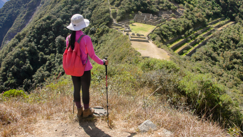
Yes, if you arrive prepared. From Marampata you get the first great views of the citadel, and on day 3 you explore it almost on your own, with far fewer people than at Machu Picchu. Arriving on foot, after crossing the canyon, feels very different from stepping off a bus.
If the calm of little-visited places appeals to you, take a look at other lesser-known Inca sites near Cusco.
FAQ: how hard is the Choquequirao trek?
Is Choquequirao harder than the Inca Trail?
On our tour pages, both are rated difficult and the effort is comparable, but different. The Classic Inca Trail climbs to about 4,215 m (13,830 ft) and concentrates the effort on stone steps and the second day. Choquequirao never goes above about 3,050 m (10,010 ft), but you go down into the canyon and back up on the way in and on the way out, in more heat.
Do I need previous trekking experience?
It is not required and the trail is not technical, but we recommend it: ideally, you have already done a multi-day hike. What you really need is good physical fitness.
Will the altitude affect me?
Less than on other routes, because the citadel is below Cusco and the lowest point, by the river, is at about 1,500 m (4,920 ft). Even so, fatigue and headaches are common: acclimatize for at least 1 day in Cusco and drink plenty of water. If you plan to take acetazolamide (Diamox), check with your doctor first.
What happens if I get tired on the trail?
We hike in groups of 8 to 12 people and the guide adjusts the breaks to the group’s pace. Tell your guide if you feel extreme fatigue, a strong headache or dizziness: we carry a first-aid kit and emergency oxygen.
Can I rent a sleeping bag and trekking poles?
Yes. They are not included, but we can rent them to you before departure. Let us know in advance if you need them.
Book with a local operator in Cusco
Ready? Book our 4-day, 3-night Choquequirao trek: from US$450 per person, with private transport, a guide in English, Spanish or Portuguese, camping, every meal on the trek and the entrance fee. You pay 40% online and the balance when you arrive in Peru.
Not sure you are ready? Contact us with your hiking experience and your dates, and we will help you choose between Choquequirao and the other routes.