English
 Español
 Português


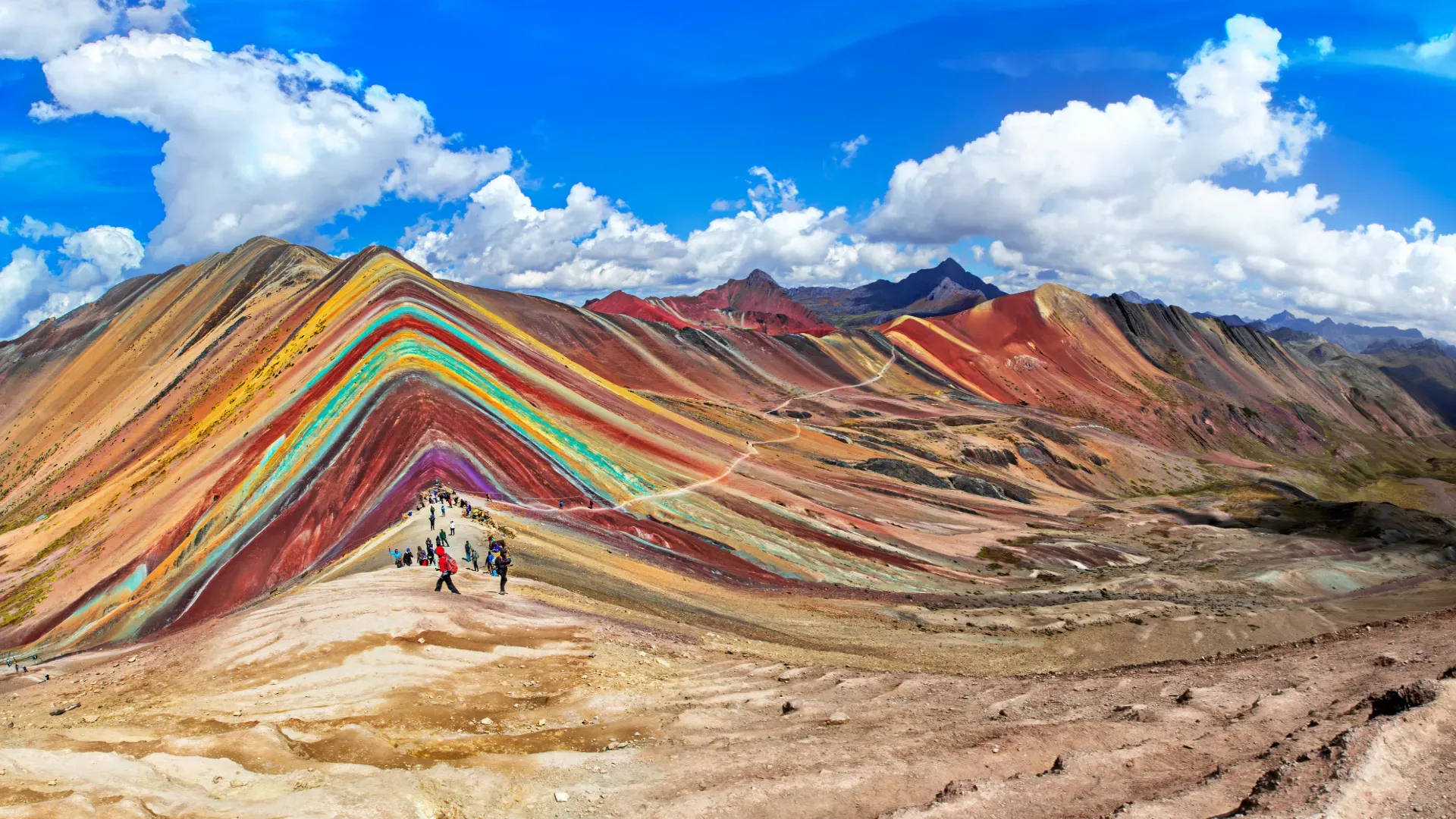
Rainbow Mountain Peru, also called Vinicunca, is a mountain striped with mineral layers in the Pitumarca district, about 3 hours southeast of Cusco. Its summit sits at about 5,200 m (17,060 ft) and is reached on a 1.5 to 2-hour hike from the trailhead at about 4,600 m (15,091 ft).
We are a local operator based in Cusco. This guide covers what you need to know before you go: elevation, getting there, the hike, the best season, what to bring and how it compares with nearby rainbow mountains.
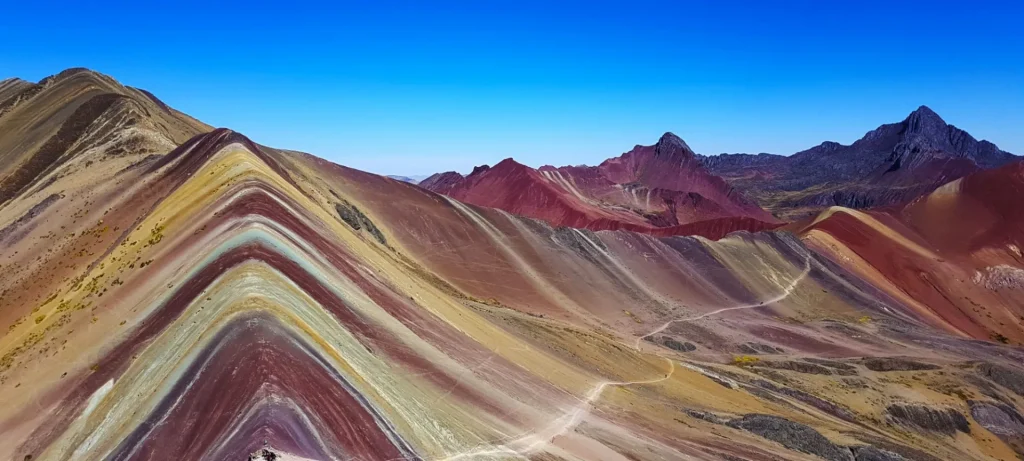
Vinicunca quick facts
| Fact | Details |
|---|---|
| Location | Pitumarca district, Canchis province, Cusco region |
| Elevation | Trailhead at about 4,600 m (15,091 ft); summit at about 5,200 m (17,060 ft) |
| Hike | 1.5 to 2 hours uphill |
| Difficulty | Moderate because of the altitude; non-technical trail |
| Best time | Dry season, April to October |
| From Cusco | About 3 hours by vehicle to the southeast |
What Is Rainbow Mountain Peru and Why Is It So Colorful?
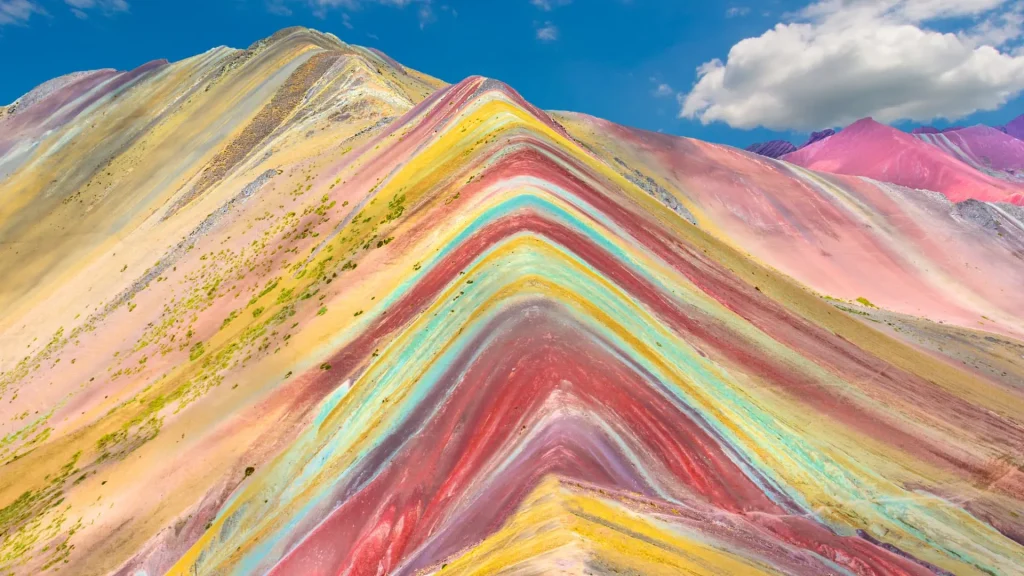
Vinicunca is an Andean mountain whose slopes show stripes of different colors stacked one on top of another. It isn’t paint and it isn’t a photo filter: the stripes are layers of sediment with different minerals that erosion has exposed over time. Each mineral gives its layer a different shade, which is why the contrast is so striking.
Its Spanish nickname, “Mountain of 7 Colors,” is a popular name, not an exact count. Depending on the light, the clouds and the time of day, you will see more or fewer shades. You will also hear it called Rainbow Mountain, Rainbow Mountain Cusco or simply Vinicunca, and it is the best known of the Peru rainbow mountains.
For the local communities, the mountains around Ausangate are apus, protective peaks that are respected as living beings. If you are curious about that cultural side, read our article on Vinicunca, the mountain of seven colors, and its guardian spirits.
Where Is Rainbow Mountain Peru?
The mountain is in the Pitumarca district, Canchis province, in the Cusco region of southern Peru, on the route toward the snow-capped Ausangate. From the city of Cusco, it takes about 3 hours by vehicle to the southeast, through Andean valleys and villages.
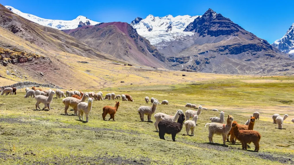
The drive is part of the experience: high-altitude villages, grasslands, and herds of alpacas and llamas grazing in front of snowy peaks. This is a rural area, and the tourism the mountain brings is also a source of income for the local community.
Rainbow Mountain Peru Elevation: How High Is It?
This is the most important number for planning your trip. The hike starts at about 4,600 m (15,091 ft) above sea level, and the summit is at about 5,200 m (17,060 ft). For reference, the city of Cusco sits at about 3,400 m (11,155 ft), so on the day of the hike you will be around 1,800 m (5,900 ft) higher than where you sleep.
At that elevation the air holds less oxygen and your body notices right away: you breathe faster and every effort feels harder. You don’t need to be a mountaineer, but you do need to keep a steady pace and arrive acclimatized. We explain how to prepare further down.
How to Get to Rainbow Mountain from Cusco
There are two ways to reach the mountain: on a full-day tour or on your own.
On a tour. This is the most practical option, because the drive is long and it pays to start hiking early. On our Rainbow Mountain tour to Vinicunca, we leave Cusco at 4:00 a.m. and return between 5:00 and 6:00 p.m. The tour includes transportation, breakfast, a buffet lunch, the entrance fee, a guide and trekking poles.
On your own. You can also go without a tour by combining public transportation to Pitumarca with a local transfer to the trailhead. Schedules and frequencies change, so it is best to confirm them in Cusco the day before. Keep in mind that you will need to pay the entrance fee on site, sort out your own meals and reach the trailhead early enough to hike up and back in daylight.
If this is your first time above 4,500 m (14,764 ft), we recommend not hiking alone: a guide sets the pace and knows when it is time to rest or turn back.
Book with 40%: the Vinicunca tour starts at US$50, and you can secure your spot by paying 40% online. The balance is paid in Peru.
What the Hike Is Like and How Hard It Is
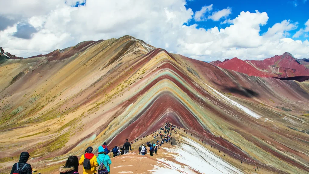
From the trailhead at about 4,600 m (15,091 ft), the climb takes 1.5 to 2 hours at a relaxed pace. The trail is not technical: you don’t need mountain experience or special gear. The difficulty is moderate, and it comes from the altitude, not the terrain.
The best approach is to go slowly, with short breaks to catch your breath and drink water. You will feel the effort most on the upper section, where the air is thinner. At the top there is time for photos, and the descent is usually quicker than the climb; take it carefully and use your poles.
If you don’t feel up to walking the whole way, horses can be rented at the trailhead. They are paid directly to the local community’s horsemen (arrieros), so it is also a way to keep tourism income in the area.
Altitude Sickness and Acclimatization
Altitude sickness, known in the Andes as soroche, can affect anyone, regardless of age or fitness. The most common symptoms are headache, fatigue, nausea and trouble sleeping. To lower the risk, we recommend spending at least 1 or 2 days in Cusco before hiking Vinicunca. In our article on why locals in Cusco don’t suffer from altitude sickness, we explain how the body adapts to the city’s elevation.
These are the steps we recommend to our travelers:
- Schedule the hike for the end of your stay in Cusco, not the day after you arrive.
- Drink water often and eat light the night before and at breakfast.
- Avoid alcohol the night before the hike and try to get a good night’s sleep.
- Walk at your own pace and don’t try to keep up with the rest of the group.
- If your symptoms get worse on the way up, tell your guide and head down.
For symptoms, prevention and what to do if you feel unwell, see our guide on how to prevent altitude sickness in Peru, and to plan your days in the city, our essential tips for a trip to Cusco. If you have a health condition, check with your doctor before you travel.
Best Time to Visit and Weather
The best time to visit Vinicunca is the dry season, from April to October. In those months the sky is usually clearer, the trail is dry and the colors look sharper.
From November to March there is more rain. The trail can get muddy and the summit sometimes wakes up under snow, which covers the colored stripes. You can still go, but keep your dates flexible: a view of the colors is not guaranteed.
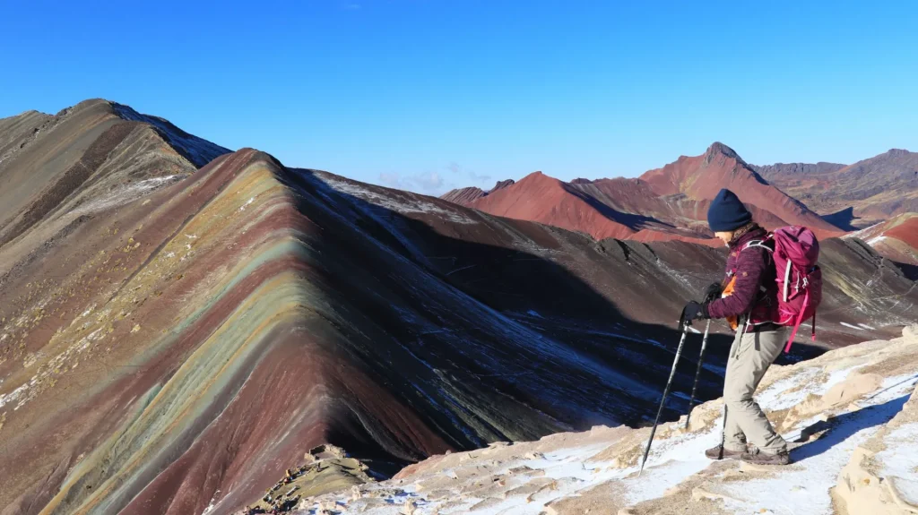
Whatever the season, early mornings are cold and the high-altitude sun is strong. Start with several layers, peel them off as the day warms up, and wear sunscreen even when it is cloudy.
What to Bring to Rainbow Mountain
Pack light, but don’t leave anything important at the hotel. This is the list we recommend:
- Layers: a thermal base layer, a fleece and a windproof or waterproof jacket.
- A warm hat, gloves and a scarf or neck gaiter for the early morning.
- A cap or sun hat, sunglasses and sunscreen.
- Hiking shoes or boots with good grip.
- A rain poncho, especially from November to March.
- Enough water for the hike and a few snacks.
- Cash in Peruvian soles to rent a horse or buy something from the community.
- Your personal medication and a small daypack.
Trekking poles are included on our tour, so you don’t need to bring your own. Breakfast and the buffet lunch are included too.
Vinicunca vs. Palcoyo vs. Pallay Punchu: Which One to Choose?
Vinicunca is the best known, but it is not the only rainbow mountain near Cusco. These are the main differences between the three options we run:
| Vinicunca | Palcoyo | Pallay Punchu | |
|---|---|---|---|
| Location | Pitumarca, Canchis | Checacupe | Layo, Canas |
| Highest point | ~5,200 m (17,060 ft) | ~4,900 m (16,076 ft) | ~4,800 m (15,748 ft) |
| Hike | 1.5 to 2 h uphill; moderate because of the altitude | 45 min to 1 h; short and easy | 1 to 2 h uphill |
| Highlight | The most famous colored stripes, on the route to Ausangate | Short walk and a stone forest | Rocky ridges and few visitors |
| Tour from | US$50 | US$50 | US$60 |
Choose Vinicunca if you want to see Peru’s most famous rainbow mountain and you are acclimatized for a 1.5 to 2-hour climb to about 5,200 m (17,060 ft).
Choose Palcoyo if you want a short, easy walk of 45 minutes to 1 hour, with a stone forest as a bonus. It is a good alternative if you prefer less physical effort. Read our Palcoyo guide or check out the Palcoyo tour.
Choose Pallay Punchu if rocky ridges appeal to you and you prefer a quiet place with few visitors. It is in Layo, Canas province, and the climb takes 1 to 2 hours. You will find more details in our Pallay Punchu guide and on the Pallay Punchu tour page.
Rainbow Mountain FAQ
How long is the Rainbow Mountain tour?
It is a full day. We leave Cusco at 4:00 a.m. and return between 5:00 and 6:00 p.m. About 6 hours of that time is spent driving, there and back.
Can you ride a horse up?
Yes. Horses can be rented at the trailhead and are paid directly to the community’s horsemen. It is a good option if the altitude affects you or you would rather save your energy.
Is there snow on Vinicunca?
There can be, especially between November and March, when the summit sometimes wakes up under snow and the colors are hidden. In the dry season, from April to October, it is less likely.
Are Vinicunca and Palcoyo the same mountain?
No. They are different places. Vinicunca is in Pitumarca and Palcoyo is in Checacupe. Palcoyo has a shorter, easier walk of 45 minutes to 1 hour and adds a stone forest.
How much is the tour and how do I book?
Our Vinicunca tour starts at US$50. You can book online by paying 40%, and the balance is paid in Peru.
Plan Your Visit to Vinicunca
Rainbow Mountain Peru rewards travelers who arrive prepared: acclimatized, dressed in layers and aware of what it means to hike above 4,600 m (15,091 ft). If you pick the right season and climb at your own pace, the hike is demanding, but it doesn’t require any mountain experience.
If you would like to go with a local operator, take a look at our Rainbow Mountain tour and reserve your spot with 40%. If you have questions about dates or acclimatization, get in touch and we will help you plan it.